Geomatics Engineering

Geomatics engineering manages global geospatial resources and infrastructure. We handle the design, development, and operating systems for collecting, analyzing, and utilizing geospatial information about the land, infrastructure, the oceans, natural resources, and the environment.

We conduct property boundary determinations for the definition of legal boundaries for land ownership, digital mapping, geodesy, geographic information systems (GIS), global positioning systems (GPS), land information management, subsurface utility engineering, and remote sensing surveys using sUAS (small Unmanned Aircraft Systems) technology.

Surveying has been an element in the development of the human environment since the beginning of recorded history. The planning and execution of most forms of construction require it and it is an important tool for research in many other scientific disciplines.

Civil Engineering

Civil Engineering is the design and calculation of the grading of land, drainage systems, pavement, water supply, sewer service, electric and communications supply. We also perform beach renourishment and stabilization studies and permitting, as well as the design of docks and bulkheads.

We primarily focus on converting a tract of land from one usage to another. Our engineers spend time visiting project sites, meeting with stakeholders and regulators, and preparing construction plans for permitting, as well as overseeing construction as an owners representative.

We apply the principles of  geomatics engineering, geotechnical engineering, structural engineering, environmental engineering, coastal engineering, transportation engineering and construction engineering to residential, commercial, industrial and public works projects of all sizes and levels of construction.

Environmental Compliance

Environmental Compliance is conforming to environmental laws, regulations, standards and other requirements such as site permits to operate. Environmental concerns have led to a significant increase in the number and scope of compliance imperatives across all regulatory environments. Environmental concerns and compliance activities are increasingly being aligned with corporate performance goals and being integrated to some extent to avoid conflicts, wasteful overlaps, and gaps.

Environmental Services include Phase 1 & 2 Environmental Site Assessments and Transaction Screenings, Underground Storage Tank (UST) Assessments and Closures, Erosion Control Planning & Stormwater Monitoring, Storm Water Pollution Prevention Plans (SWPPP), Spill Prevention Control and Countermeasure Plans (SPCC), Industrial Process Waste Water Permitting, Wetland and State Waters Impact (CWA), Wetland Delineation and Endangered Species Studies, and Environmental Field Services.

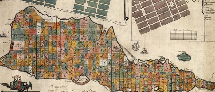
stx quarters

Extensive Land Property Records on St Croix

Formerly Frank Dospiva & Associates (1982-2004), GME Dospiva (2004-2011), Jeffrey Bateman and BCSC Dospiva have been in operation on St Croix since 2011. Our records have been maintained and are available for our research - this keeps the cost of our surveys low as we often have surveys and mapping in the vicinity of your project.

Professional Engineering & Surveying Registrations

We are licensed and registered with the Secretary of States and Boards of Registration for Engineering and Land Surveying in these states. We have agreements with professional consultants in most other states that will assist us in completing your project with just one point of contact.
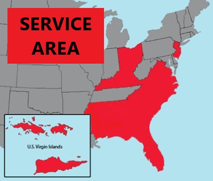
state map

Contact Us -

If you would like more information on the services we offer, or have a specific project that you would like to discuss, please click on the button to the left and we will be back in touch with you promptly.