
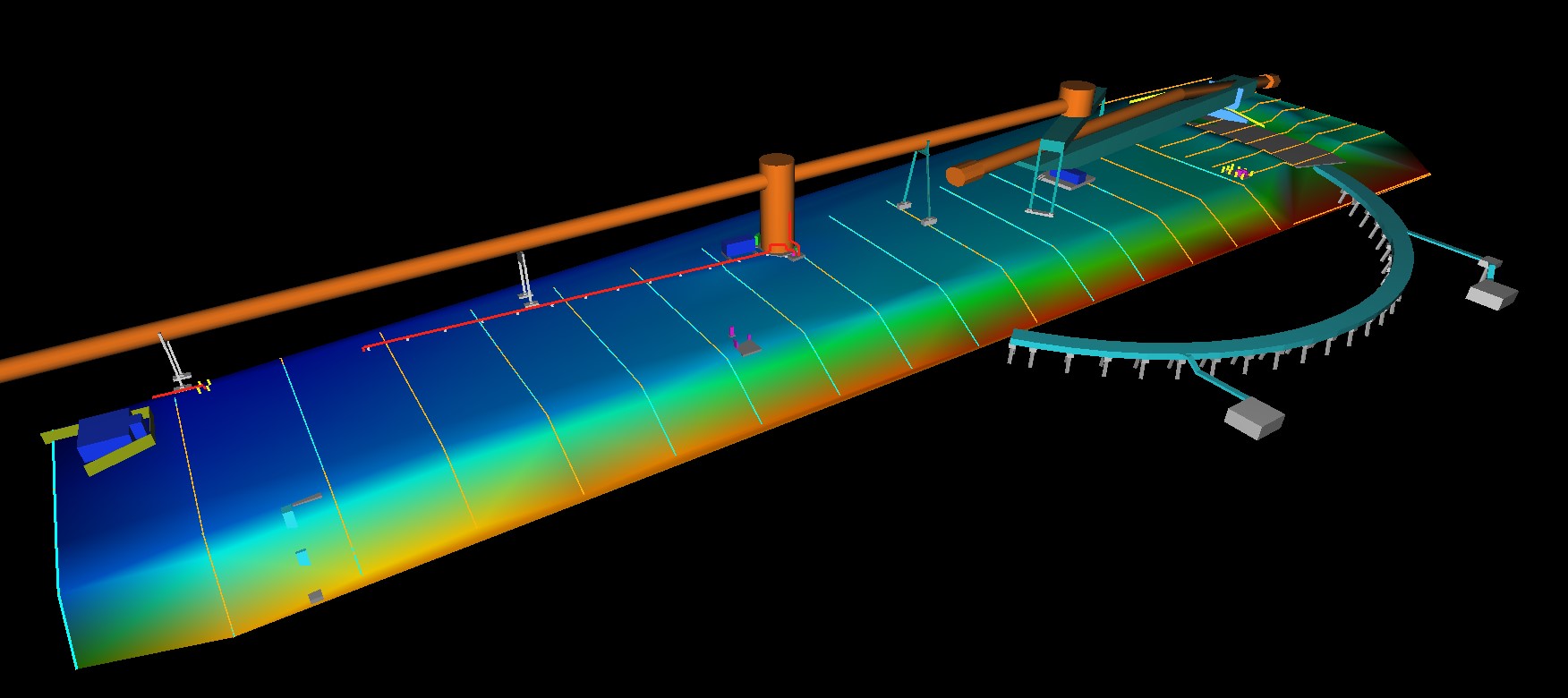


Limetree Bay Terminals, St Croix, VI
BCSC Dospiva was chosen to perform hydrographic and topographic surveys for a new pipeline from Limetree Bay Terminals to a proposed mooring site approximately 1.5 miles offshore. A total of 1,100 acres were surveyed offshore. Topographic surveys were performed for the onshore route of the proposed pipeline, including 3D laser scanning surveys of the existing elevated pipe racks, coke domes and the loading arm facilities. Ground Penetrating Radar was used to determine depths of underground utilities as they affect the constructed path of the new pipeline.
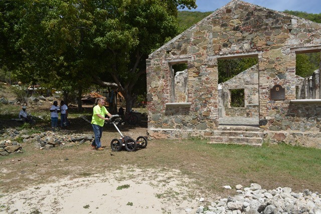
Ground Pentrating Radar Surveys, Tortola, BVI
BCSC Dospiva performed Ground Penetrating Radar (GPR) Surveys at 4 separate sites on Tortola in the BVI to locate old unmarked graves. These sites included St. Phillips Church, the HM Prison Museum, Hodge Quaker Burial Grounds and on Great Thatch Island. The use of Ground Penetrating Radar (GPR) to perform a geophysical investigation for the purpose of locating unmarked graves is the most widely used geophysical method for cemetery investigations. For cemeteries, one will not see remains in the ground. Instead, grave shafts, grave excavation edges, stones used to outline and mark the grave site and remnants of caskets if any, will be imaged. Interpretations about the presence or absence of human burials are drawn from the GPR imagery. For cemeteries with missing or destroyed burial records, a GPR survey can produce a composite site map of an area that would indicate grave locations, positions and their depth.
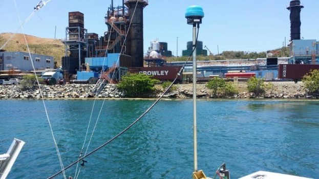
Virgin Islands Water & Power Authority, St Croix & St Thomas, VI
BCSC Dospiva has performed topographic, hydrographic, geophysical and underwater engineering inspection surveys for the LPG conversion of the Virgin Islands Water and Power Authority plants on St. Thomas and St. Croix for Vitol based in The Netherlands. BCSC has performed boundary and topographic surveys, utility locations, and water resource management for both projects including, soil erosion and sedimentation control plans, grading design, Stormwater Pollution Prevention Plans and assistance with local permitting. We have performed offshore surveys using an echosounder, sub bottom profiler, magnetometer, and sidescan sonar, for the areas around the fueling docks at both plants, as well as for a mooring location 5 miles offshore. We performed underwater engineering inspections of docks at both plants, including steel thickness measurements, videography and sample collection. We have also performed structure and roadway inspections pre-construction, to document existing conditions using videos and still frame photography.
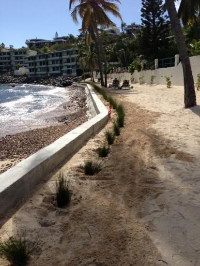
Watergate Villas East, St Thomas, VI
BCSC Dospiva conducted topographic and benthic surveys, performed an Environmental Assessment, prepared design plans and construction specifications, and permitted the project through the USVI Department of Natural Resources Coastal Zone Management Program. Erosion of the existing shoreline has destabilized the slope and has put the foundations of Buildings 16 and 17 at risk of future storm damage. The beach will be returned to pre-hurricane conditions, and lighting, irrigation, and new plantings will be installed as part of the project. A Major Land Permit Amendment has been approved by CZM and the project is complete, except for mangrove plantings.